Fairy Meadows is the most accessible place in Pakistan to stand in front of an eight-thousander, and the journey there is famous enough to be a destination in itself. It is also the trip people most often arrive at underprepared. Here is the whole thing, honestly.
Getting there: three legs, and only one of them is a road
Leg one is the Karakoram Highway to Raikot Bridge, around 10 hours from Islamabad. Leg two is the Raikot jeep track: roughly 16 km up the gorge to Tato, unbarriered, single-lane and cut into the valley wall. It is driven exclusively by the local jeep union, whose drivers do the run several times a day. You cannot take your own vehicle up it, and you should not want to.
Leg three is on foot. From Tato it is about three hours uphill to the meadow — four to five kilometres, but continuously climbing. Mules are available for bags and for people who need them. There is no road to the meadow and there is not going to be one.
What is actually at the top
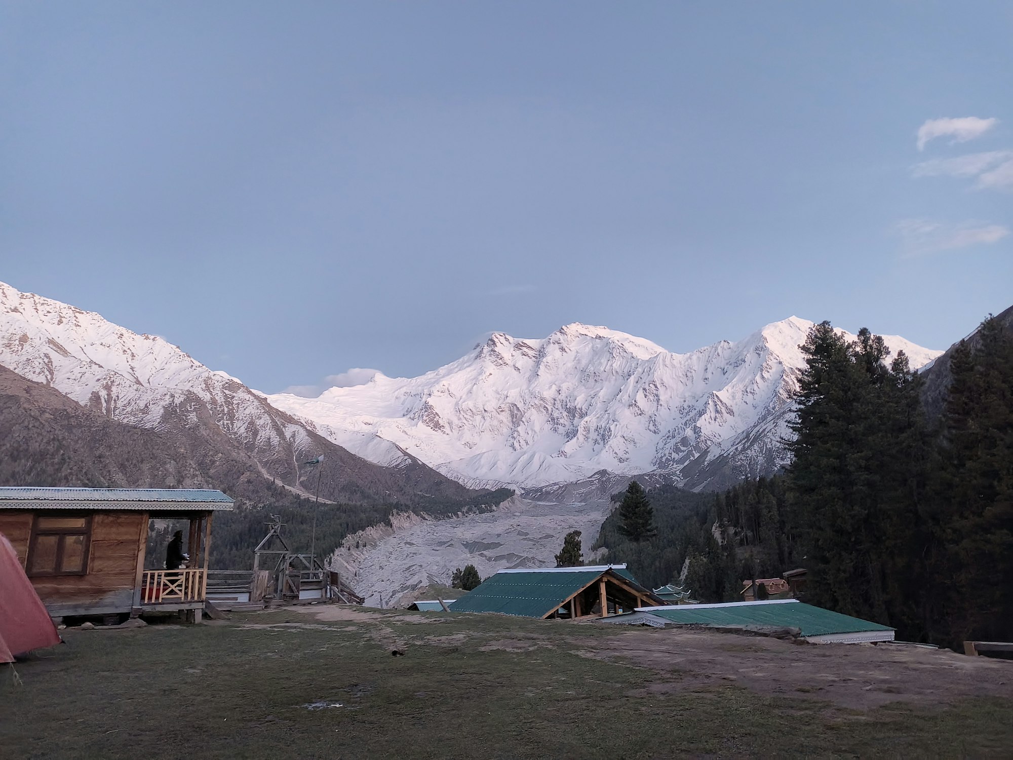
A shelf of alpine grass and pine at roughly 3,300 m, with the Rakhiot face of Nanga Parbat — 8,126 m, the ninth-highest mountain in the world — filling the southern horizon. Accommodation is wooden huts and permanent tents run by a handful of camps. Electricity is solar and intermittent, hot water is a bucket, and mobile signal is essentially absent.
It is more comfortable than it sounds and less comfortable than a hotel. Go expecting a mountain hut and you will be pleased.
The walk everyone comes for: Beyal and the base camp viewpoint
From the meadow, a marked trail runs to Beyal Camp in about an hour and a half, then continues toward the Nanga Parbat base camp viewpoint above the Rakhiot glacier — another hour and a half to two hours beyond Beyal.
The full return is six to seven hours at a comfortable pace and involves a glacier moraine section that is straightforward but loose. Start early: cloud usually builds on the face from late morning, and the clear view is a morning event.
What to bring
A warm layer and a windproof, whatever the month — at 3,300 m the temperature falls fast once the sun goes behind the ridge. Proper walking shoes with grip, not trainers, for the Tato climb and the moraine. A headtorch, because lighting is solar. A power bank. Cash in small notes, as there is no card payment and no ATM past Chilas.
How long to allow
Four days from Islamabad is the workable minimum: one day up the KKH, one in and up, one for the Beyal walk, one back down and out. Three days is possible only if you fly to Gilgit and it leaves you no margin for weather.
Two nights at the meadow is markedly better than one. The first afternoon usually goes on arriving and recovering; the reward is the second morning.
When to go
May through October. July and August are warmest and busiest. Late September and early October give you the clearest air and the best photographs, with cold nights. Outside that window the jeep track and the meadow are under snow.
Frequently asked
The walk from Tato is three hours of steady uphill on a clear path — moderate rather than hard, but genuinely uphill. Anyone who walks regularly will manage it. Mules can carry bags.
No. Jeeps stop at Tato and the final four to five kilometres are on foot or by mule.
Yes, as a destination. The Raikot jeep track is exposed and should only be driven by union drivers in daylight, which is standard practice. The walk itself is on a well-used path.
Effectively none. Tell people at home you will be offline for two days.